MENU

Projects

MENU

Projects

What's on the IQT Labs work bench?

Projects

All Projects
Edge
Data
Trust
  • Project

SkyScan

Automatic collection of labeled datasets

  • Data, Edge
Quick Look
  • Data, Edge

SkyScan

Automatic collection of labeled datasets

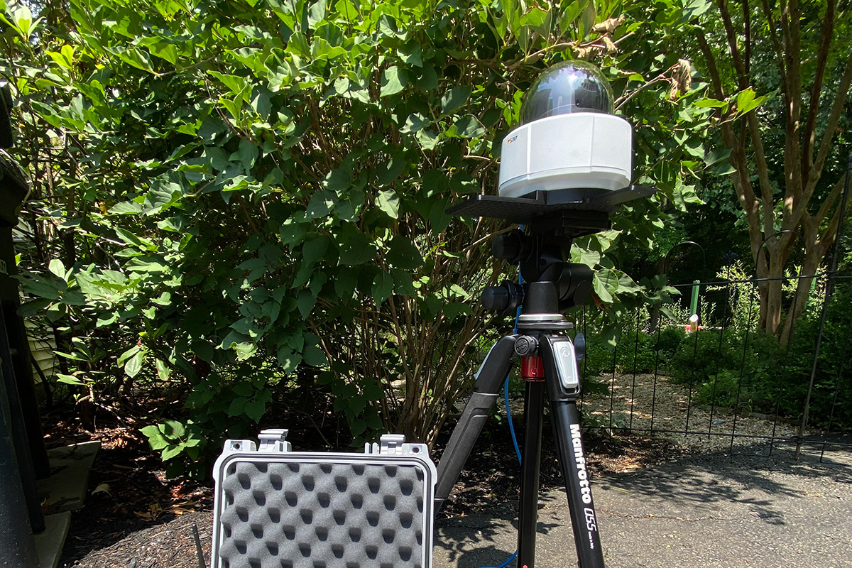
Quickly and efficiently building and labeling image datasets for machine learning applications can be a prohibitively time-consuming and expensive activity. SkyScan demonstrates a low-cost system that can capture images of aircraft in flight and automatically label the image with captured metadata.
LEARN MORE
  • Project

Synthesizing Robustness

Improving synthetic data with generative deep learning networks

  • Data
Quick Look
  • Data

Synthesizing Robustness

Improving synthetic data with generative deep learning networks

It is generally thought that a good AI model needs a lot of good data. But what about when it is unfeasible or unreasonable to collect such a large dataset? How best to leverage small datasets for machine learning tasks is an active area of exploration. Synthetic data has the potential to alleviate object rarity and long-tail distributions, provided the synthetic data introduces more signal than noise into the system.
LEARN MORE
  • Project

AI Sonobuoy

Designing a $100 AI-Enabled Sonobuoy

  • Edge
Quick Look
  • Edge

AI Sonobuoy

Designing a $100 AI-Enabled Sonobuoy

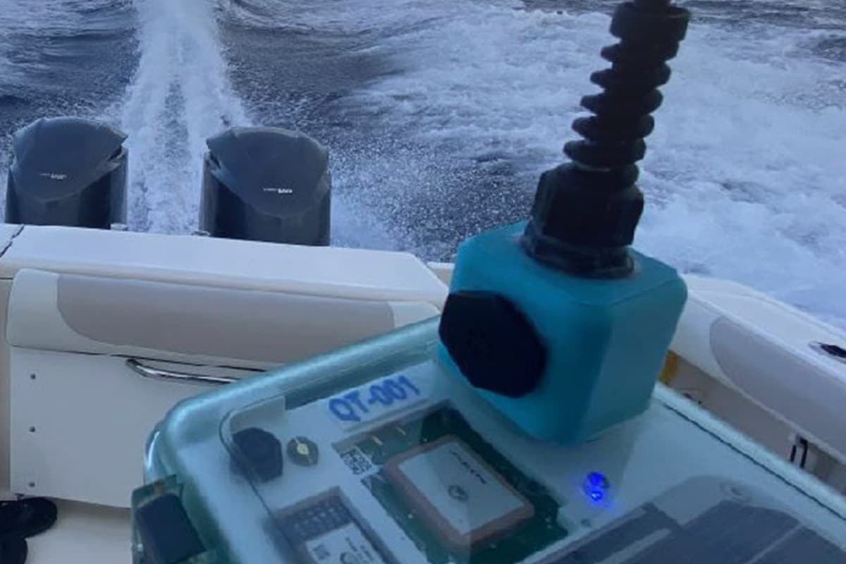
You can now do a lot more with a lot less when it comes to deploying AI systems. Low-power edge inference techniques are fundamentally changing the design of fieldable smart sensors. This project is looking at the evolution of design in AI enabled, acoustic sensors that live at the edge by designing and fielding a smart hydrophone.
LEARN MORE
  • Project

Daedulus

DIY Open Source cell towers for research

  • Edge
Quick Look
  • Edge

Daedulus

DIY Open Source cell towers for research

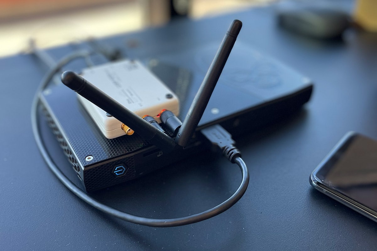
This project spun up a fully operational 5G mobile phone infrastructure based on Open Source code and low cost commercially available Software Defined Radios and Computers.
LEARN MORE
  • Project

Birdseye on RF

Using low-cost sensors to locate the source of an RF signal

  • Edge
Quick Look
  • Edge

Birdseye on RF

Using low-cost sensors to locate the source of an RF signal

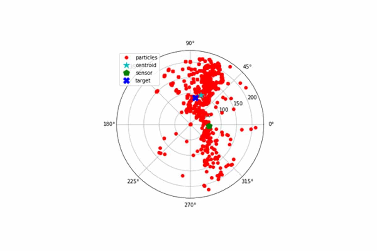
These days there are all kinds of invisible signals in the environment around us. If you see a problematic consumer drone in your area, how do you find its operator? In the Birdseye project, we simulated the use of mobile, low-cost sensors to geolocate a moving RF-signal. More specifically, we simulated the collection of RF signals coming off a commercial drone flying overhead to see if we could use it to locate its controller.
LEARN MORE
  • Project

AI Assurance Auditing

Identifying risks before AI is deployed

  • Trust
Quick Look
  • Trust

AI Assurance Auditing

Identifying risks before AI is deployed

IQT Labs is developing a pragmatic, multi-disciplinary approach to auditing AI & ML tools. Our goal is to help people understand the limitations of AI/ML and identify risks before these tools are deployed in high stakes situations. We believe auditing can help diverse stakeholders build trust in emerging technologies...when that trust is warranted. For more info, check out this report which describes our auditing approach and what we found when we audited FakeFinder an Open Source deepfake detection tool.
LEARN MORE
  • Project

FakeFinder

Batch processing of deepfake detection within videos

  • Trust
Quick Look
  • Trust

FakeFinder

Batch processing of deepfake detection within videos

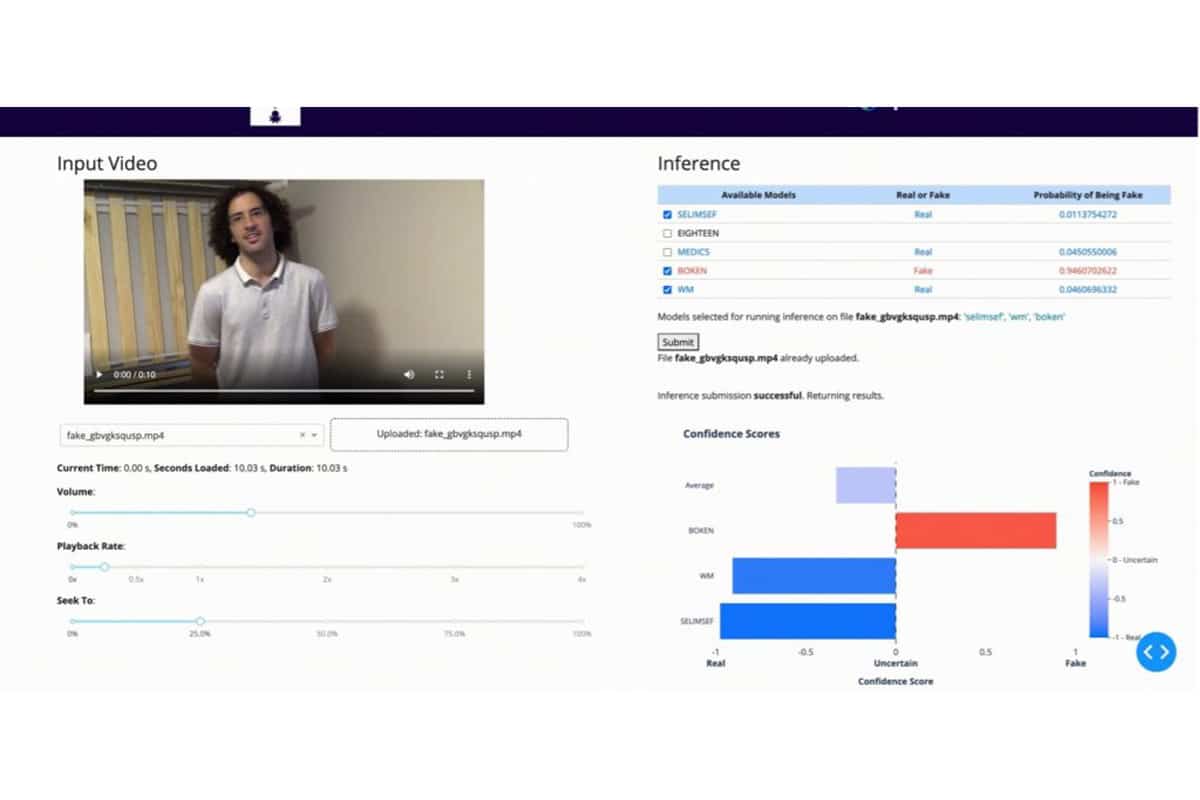
Increasingly fake videos are popping up around us because DeepFake generation models are getting better at producing realistic output at an alarming scale. FakeFinder was a hands-on project aimed at better understanding Open Source models that can be effective for debunking such videos at a similar rate.
LEARN MORE
  • Project

Where in the World

Verifying the geographic location of outdoor images

  • Data
Quick Look
  • Data

Where in the World

Verifying the geographic location of outdoor images

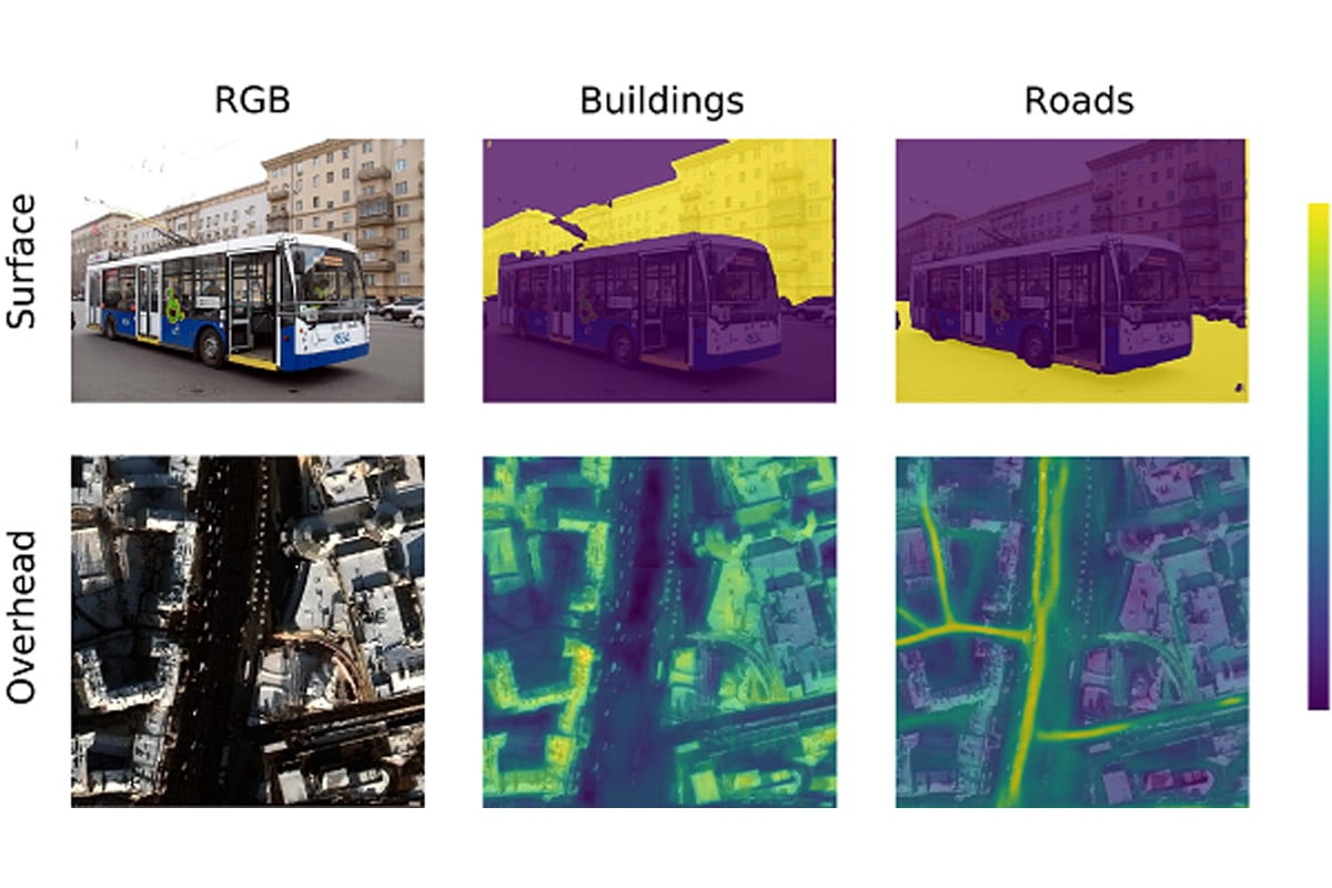
Suppose that a photograph has surfaced under dubious circumstances, raising the question of where it was really taken. One potential solution, cross-view image geolocalization (CVIG), is the process of geolocating an outdoor photograph by comparing it to satellite imagery of possible locations. This project touched on each major component of CVIG deep learning.
LEARN MORE
About
Explore
Projects
Contact

Copyright © 2022 · IQT Labs LLC.  All Rights Reserved.

Twitter Github

Terms of Use | Privacy Policy

CLOSE
ABOUT
EXPLORE
EDGE
DATA
TRUST
PROJECTS
CONTACT

We use cookies to offer you a better experience. By continuing to use this website, you consent to the use of cookies in accordance with our Privacy Policy. Read More

Accept